The valleys
Ridnaun
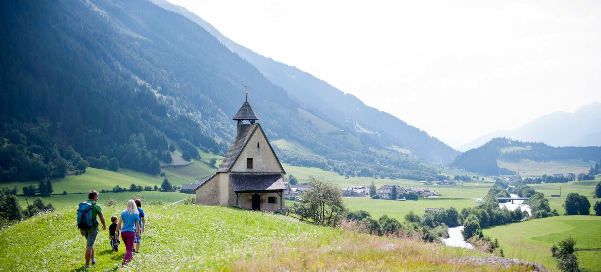
You reach the valley of Ridnaun westwards from the basin of Sterzing. After the village Mareit with its impressive baroque palace Wolfsthurn (domicile of the state museum for hunting and fishing) you reach the high valley of Ridnaun (1300-1550 metres) via an escarpment.
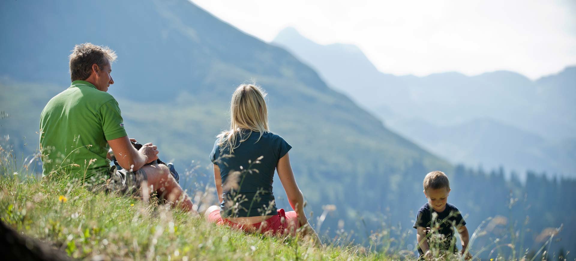
It is one of the most beautiful high valleys of South Tyrol. Scenically it is the valley of contrariness. The high valley itself with its smooth shapes, which the glaciers formed millions of years ago, stands contrary to the impressive panorama of the Stubaier Alps with its lordly peaks, rocks and glaciers. In summer lush meadows in the valley floor invite you to a walk in the heart of nature. Enjoy the wonderful cultural landscape which has arisen from a clever symbiosis of tourism, mountain scenery, tradition and customs. You will find innumerable hiking routes in all levels of difficulty. You can choose between operated mountain pastures, high alpine refuges, picturesque glacier lakes and the highest peaks of the alpine region. In the mining area around the Schneeberg you can trace the footsteps of ancient mining.
In winter Ridnaun doesn’t lose its scenically beauty. Under a deep snow layer the high valley seems even smoother. The vastness of the landscape, the forests, the bizarre rock formations and the snow covered hills and mountain peaks unfold a deep, calming effect on the beholder. Live your winter dream on the cross-country ski run or the winter hiking route along the Ferner River and breathe in the fresh, crystal clear mountain air. And when the snow layer melts the first traces of spring appear here on the rolling hills in soft crocus carpets. Then the cycle of nature has begun again anew and the white brightness will soon give way to green meadows again.
Pfitsch
You reach the high valley of Pfitsch eastwards from Sterzing. Cross the village Wiesen, which secludes the valley floor of Sterzing’s basin in the eastward direction, and reach the storage lake of Pfitsch via the escarpment of Afens. The storage lake was implemented as one of the numerous generating plant projects of the fascistic government in the thirties and is proof of one of the darkest chapters of Pfitsch.
The valley of Pfitsch is still one of the most pristine Alpine valleys. Agriculture shapes the valley and the unique cultural landscape with lush meadows, picturesque villages and astonishing mountain farms. The vastness of the valley shaped by ice and glacier and the dizzying heights of the Zillertaler Alps unite and amaze the beholder. At the top of the valley lies the Hochfeiler, the highest mountain peak of the region with 3510 metres above sea level. The valley of Pfitsch is a paradise for mineral collectors. The specific interaction of the Alps folding and erosion let emerge sediments of long gone oceans. Break lines and disruptions along this so called “Tauern Fenster” are rich in minerals and special rocks. Many a hiker has returned with big quartzes after a chance find. A guided geological hiking allows you to experience the complex origination process of today’s Alpine region realistically.
Those who visit the high valley of Pfitsch in winter learn to understand to some extent what the life of mountain farmers in the last centuries was like. Then the high valley lies under a deep snow layer. Before the modern development of infrastructure in terms of traffic the people there have been isolated from the outside world for months. Today this remoteness and untouched beauty of nature are constantly perceptible in winter as well as in summer on the wonderful cross-country ski run, when snowshoeing, ice climbing or in the warm season when hiking, mountain climbing, mountain biking and and and…
And on smugglers’ trails you reach the close-by Zillertal in the Northern part of the country.
Pflersch
The valley of Pflersch is the northernmost valley of our region slightly south of Brenner. You reach the valley via the village Gossensass, where you have to turn in north-western direction. The extraordinary beauty of this valley lies in its mountain ranges. The splendid Tribulaun is a northern foothill of the Dolomites with white lime. The name Dolomites has its seeds here. In around 1790 the geologist and mineralogist Déodat Gratet de Dolomieu travelled the old Tyrol for the first time and addressed himself to the distinctiveness of the white rocks in the valley of Pflersch. He documented the differences to the pure lime stone and wrote a paper on its development. The distinctiveness of the rocks was soon acknowledged scientifically and the mineral and the rocks, whose main component it is, were named after the French scientist.
In summer the valley of Pflersch offers good possibilities for hiking to the operated mountain pastures and the high alpine refuges (Magdeburger refuge, Tribulaun refuge etc.). The newly set up Dolomieu path leads you over six mountain pastures from the hiking region of Ladurns over the Rosskopf to Telfes and back to Sterzing. Take a rest at the pastures and try some of the self-made milk produces such as fresh butter or the traditional local cheese specialty known as “Graukäse”.
At the top of the valley the “Höllenklamm” (hell’s flume) awaits you: a deep canyon which is made accessible through steep tracks and bridges.
In winter a wonderful cross-country ski run at the foot of the stunning Tribulaun mountain and the skiing area Ladurns with its broad ski-run through the wood are at your disposal.
In the village Gossensass at the entrance of the valley you will find an art-historically jewel: Barbara’s Chapel. It is an impressive testimonial of the mining tradition of Pflersch when in bygone times silver mining led to short-time prosperity of the valley.