Hiking and bike
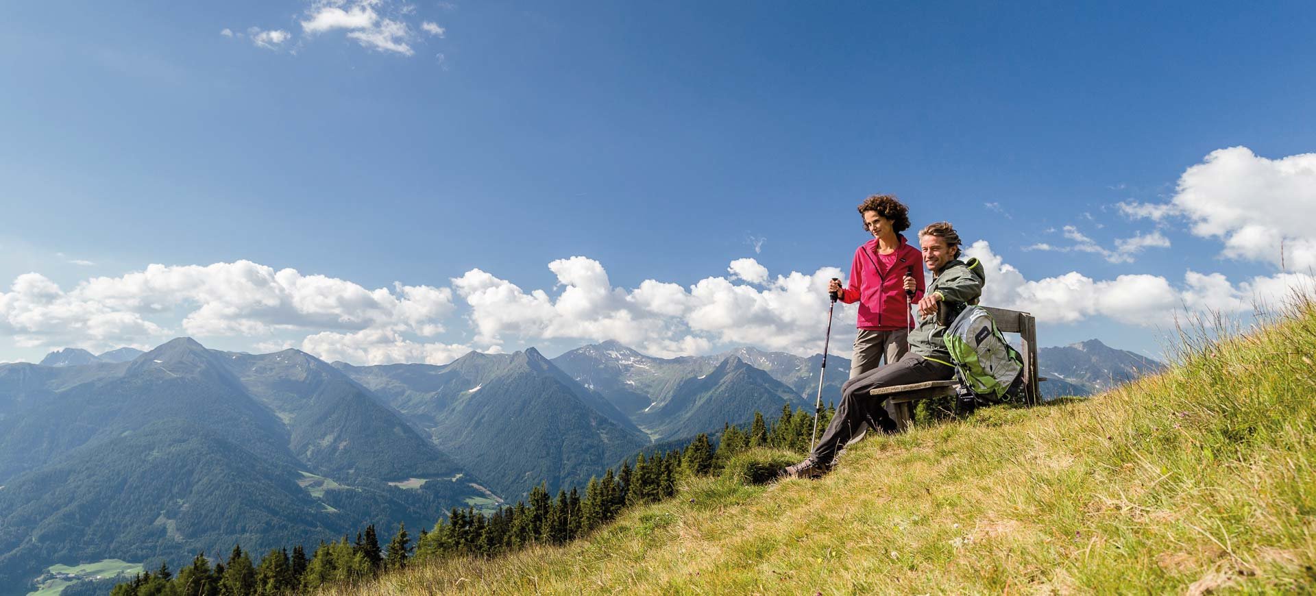
Hiking
Sterzing is located right in the heart of a superb hiking region. It’s your choice: long walks along the Eisack promenade to the nearby village Wiesen, along the river coasts of the valleys Ridnaun and Pfitsch or along the historical ore transport route of Maiern to the Ridnauner Gasse … Linger around in best air and quiet nature without much effort and without noteworthy ascents.
Or you hike on the hiking paths up to the innumerable mountain pastures to the height of the forest line. There you observe – unique in its naturalness – dairy men and women at work. Try some of the typical hand-made milk produces such as the local cheese speciality know as “Graukäse” or fresh butter.
And if you are really fit you can bear the challenge and hike to the high alpine refuges or the stunning mountain peaks. You can reach most peaks also without rock climbing experience.
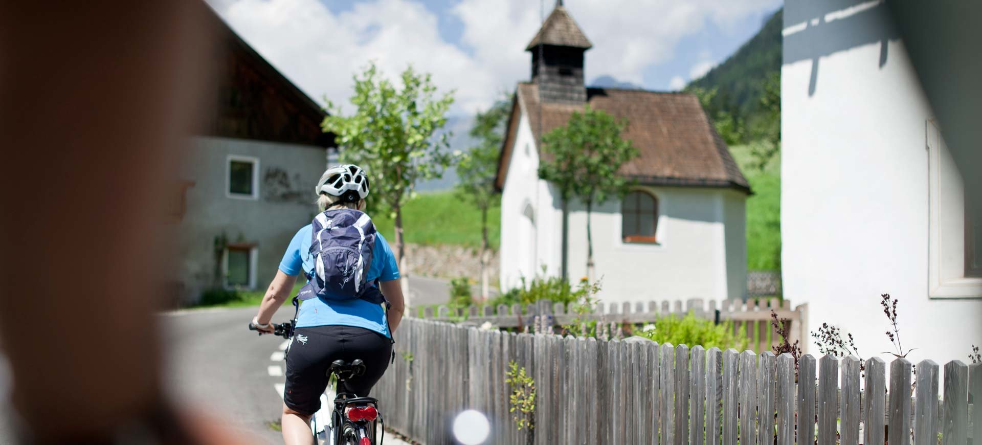
Bike
Sterzing is located right at the Brenner-bike-route (part of the bike route Munich – Verona) and with the passes Jaufen (2099 metres) and Penser Joch (2214 metres) it also offers two first-class street routes for those who love to ride a racing bike. For mountain bike fans we have many tour suggestions down pat for beginners as well as for experts, depending on fitness and proficiency in downhill. The surrounding holiday valleys Ridnaun, Pfitsch, Jaufental, Pflersch or Ratschings are accessible by bike. From there you can continue your route on logging roads or hiking trails up the level of the mountain pastures where you can take a rest and stop for a bite to eat.
You can even leave your bicycle at home. Our partner m2-Bike supplies you with the latest sport equipment at fair prices and with a comfortable delivery service to the hotel.
Hiking suggestions
Dolomieu – six mountain pastures – path
(approx. 3 hours walking – starting point mountain station – Rosskopf ropeway)
The world of rocks in this area is a real eldorado for mineral experts. Here geology history was made. Here the French scientist and adventurer Deodat de Dolomieu discovered the rock “Dolomit” which was named after him. Since then the well-known Dolomites, which are located somewhat further south-eastern, bear his name. Traditional mountain pastures of Sterzing’s farmers with typical hand-made raw milk produces are waiting for you. Enjoy your break with the cheese specialty “Graukäse”, fresh alp butter and still warm milk.
Start your tour at the valley station Rosskopf in Sterzing from where you take the ropeway up to the mountain (1860 metres). From there walk towards Kastellacke – marker number 19 A. From the pastures of Vallming go on towards Ladurns, going past the Toffringalm to Allriss in the valley of Pflersch. Public transport takes you back to Sterzing comfortably.
Peak tour to the TELFER WEISSEN 2588 m
(approx. 3 hours walking – starting point Rosskopf – ropeway)
Starting point is the valley station Rosskopf in Sterzing. You reach the mountain station (1860 metres) via marker number 19 or comfortably by ropeway. From there turn left towards Kuhalm and take the marked path number 23. Across steeper terrain the path leads up to the Ochsenscharte. Across steep serpentines you reach the east peak of the Telfer Weissen (2566 metres). The descent will first be done across the mentioned ascent to the Ochsenscharte. There the wanderer has two choices to accomplish the descent: a) without marker across the alp floors, past the mountain lake Grubenlacke, down to the Vallmingalm and then across the hiking path number 19a towards Kastellacke. b) From the Ochsenscharte you can take path number 24 to the Rosskopf “Köpfl” (challenging) and then back to the starting point. This tour requires you to be free from giddiness and requires good footwear. Walking time: approximately 3 hours.
Ridnauner High Route
(approx. 3.5 hours walking)
Starting point is the valley station of the Rosskopf ropeway in Sterzing. Via marker number 19 or by ropeway you reach the mountain station (1860 metres). There turn left and hike on the Ridnauner high route towards the mountain pastures Kuh- and Ochsenalm. Shortly after the Ochsenalm a sign shows the path (marker number 23a) to the so-called Ferchwasser, which according to historical sources is said to be extremely beneficial for your health. The path leads to marker number 23 B (Ridnauner high route). The steep track leads underneath the Telfer Weissen, past the peaks Seeber- and Wetterspitze in a height of about 2000 metres above sea level towards the end of the valley of Ridnaun. After approximately 4 hours of walking you reach the mountain pasture Prischeralm at the foot of the peak Wetterspitze. Now the path (now with the marker number 27) slopes and leads to Maiern in the backmost part of Ridnaun. From there public transport takes you back to Sterzing. For this tour you must be in very good shape and you mustn’t be afraid of heights. Suitable footwear is also required. For the “normal” hiker this tour cannot be done under 5 hours of walking.
Seven Lakes
(approx. 7 hours walking)
This tour leads you to former glacier area. Ice has shaped the landscape and has left impressive dips and dells in the area of the former glacier tongue which nowadays are filled with snowmelt. You will never forget the scenic beauty of the glacier lakes which gleam in emerald green, deep blue and pitch black.
Take path number 28 from the top of the valley of Ridnaun (the first part of the path is also a mining nature trail) through the Lazzacher valley south-western of the mountain pasture Lazzacher Alm (2113 metres, also Poschalm, beverage service). Go on until the turnoff of the marker 33 and proceed to the lake “Mittlerer Moarer Egetsee” (2468 metres). Go on up to the Egetjoch: on the northern side at the crossway with the marker 33A north-western of the lake “Hinterer Senner Egetsee” (2647 metres). Follow the marker 33 A to the lakes “Vordere Senner Egetseen” (ca. 2510 metres). Then proceed downwards to the lake “Trüber See”. Continue hiking on the marker 33 which descends directly from the Egetjoch until you reach the bridge over the Fernerbach (2118 metres). Ascend on the other side up to the refuge Grohmannhütte (2254 metres, beverage service) and on path number 9 eastwards to the Aglsboden.